Cadastral Map- Meaning and Use in Real Estate

In the real estate market, it is essential to understand the property boundaries and ownership. In this regard, a Cadastral Map plays a significant role in acting as an official record that defines land parcels, boundaries, and ownership details. Whether you’re a property buyer, a real estate developer, or an investor, knowing the significance of cadastral maps can save you from legal and administrative issues down the line.

Cadastral Map- Meaning and Use in Real Estate

What is a Cadastral Map?


A cadastral map, also known as a land ownership map, defines the real estate boundaries and division of land to determine the ownership and purpose of the land. These maps visually represent land division, showcasing each land plot’s size, shape, and ownership details. A cadastral map helps to facilitate land administration, assisting individuals and authorities to confirm the legal boundaries of any property.

Unlike a general land map or a location map, a cadastral map is much more detailed and focuses explicitly on property boundaries, making it invaluable in the real estate world.

What Details are Mentioned in Cadastral Maps?


Cadastral maps are rich with data that serve various stakeholders, including government bodies, landowners, and real estate developers. Here’s what you can expect to find in a cadastral map:

  • Property Boundaries: The precise lines that demarcate one land plot from another, making it easier to understand property limits.
  • Land Ownership: Information about who owns the land is clearly stated, providing legal clarity.
  • Parcel Numbers: On a Cadastral map, all the land is assigned a unique number, known as ‘parcel number’, for identification purposes.
  • Topographical Information: Some cadastral maps also include data on the terrain, water bodies, and vegetation, giving a holistic view of the land’s physical features.
  • Infrastructure Details: Roads, utilities, and nearby landmarks may also be mapped to show the land’s proximity to essential services.

These details can help you buy a plan confidently or assess a property’s exact boundaries via a property boundary map.

Why Use a Cadastral Map?


A cadastral map is essential for developing property, buying land, or investing. Here are some primary reasons why:

  • Legal Compliance: Real estate transactions require precise knowledge of property boundaries. A cadastral map is a legal document confirming land ownership and boundaries, preventing disputes.
  • Accurate Valuation: The land parcel map gives precise measurements and boundaries, which are crucial when determining a property’s value. Knowing the exact boundaries can help you avoid overpaying for the land.
  • Transparency in Transactions: Cadastral maps offer potential buyers and sellers a transparent and verifiable method of confirming land ownership and property size. This is especially useful when they can access property boundary maps for free online or through a governmental database.

Cadastral Map- Meaning and Use in Real Estate

Why are Cadastral Maps Important


Cadastral maps are crucial in land management and urban planning. They go beyond a simple site location plan.

  • Dispute Resolution: Cadastral maps with clear demarcation of boundaries help resolve disputes over property lines or land ownership.
  • Planning and Zoning: Governments and urban planners utilize cadastral maps to guide development, ensuring that zoning laws and urban development goals align with land use.
  • Taxation and Land Revenue: Using cadastral maps, the government assesses property taxes based on land area, ownership, and usage. A comprehensive map ensures proper taxation and avoids discrepancies.
  • Infrastructure Development: Knowing land parcel boundaries is essential for planning infrastructure projects such as roads, water pipelines, or electric grids.

Why Cadastral Maps Need to be Updated


Updating cadastral maps regularly is necessary due to constant changes in land usage, ownership transfers, and urban expansion. This is because:

  • Ownership changes: Whenever someone sells or transfers land, the cadastral map should be updated to reflect the new owner. This action ensures legal accuracy and helps prevent future disputes.
  • Land Division: When dividing a single plot into smaller plots, the cadastral map must show the new boundaries and parcel numbers.
  • Urban Expansion: As cities grow, new infrastructure projects are emerging. Authorities must update cadastral maps for new roads, utilities, and public services to ensure they remain relevant and valuable for modern urban planning.
  • Technology Advancement: Improvements in mapping technology have enabled cadastral maps today to provide more precise data, which can be invaluable for large-scale real estate development.

List of Cadastral Maps or Bhu Naksha Websites in India


Below is a list of states along with links to access and download Cadastral Maps or Bhu Naksha from their official government websites.

  Cadastral Map- Meaning and Use in Real Estate

Conclusion


Cadastral maps accurately define property boundaries, ownership details, and land usage, playing a vital role in real estate. These maps are essential tools for ensuring legal compliance, valuation, and transparency in transactions, helping to prevent disputes and guide development projects. For urban planning, infrastructure development, or taxation, cadastral maps are indispensable in ensuring smooth land management. It is crucial to keep them updated to reflect changes in ownership, land divisions, and urban expansion, making them a key component in the evolving real estate landscape.

Don't forget to share this valuable article with others

Q1. What does cadastral map mean?

A cadastral map comprehensively represents land parcels within a designated area. It’s often referred to as a Bhu Naksha or area map. These maps provide meticulous information about land divisions, boundary sizes, and the lengths of various segments.

Cadastral refers to detailed records of land boundaries, ownership, and size, used for legal, taxation, and administrative purposes.

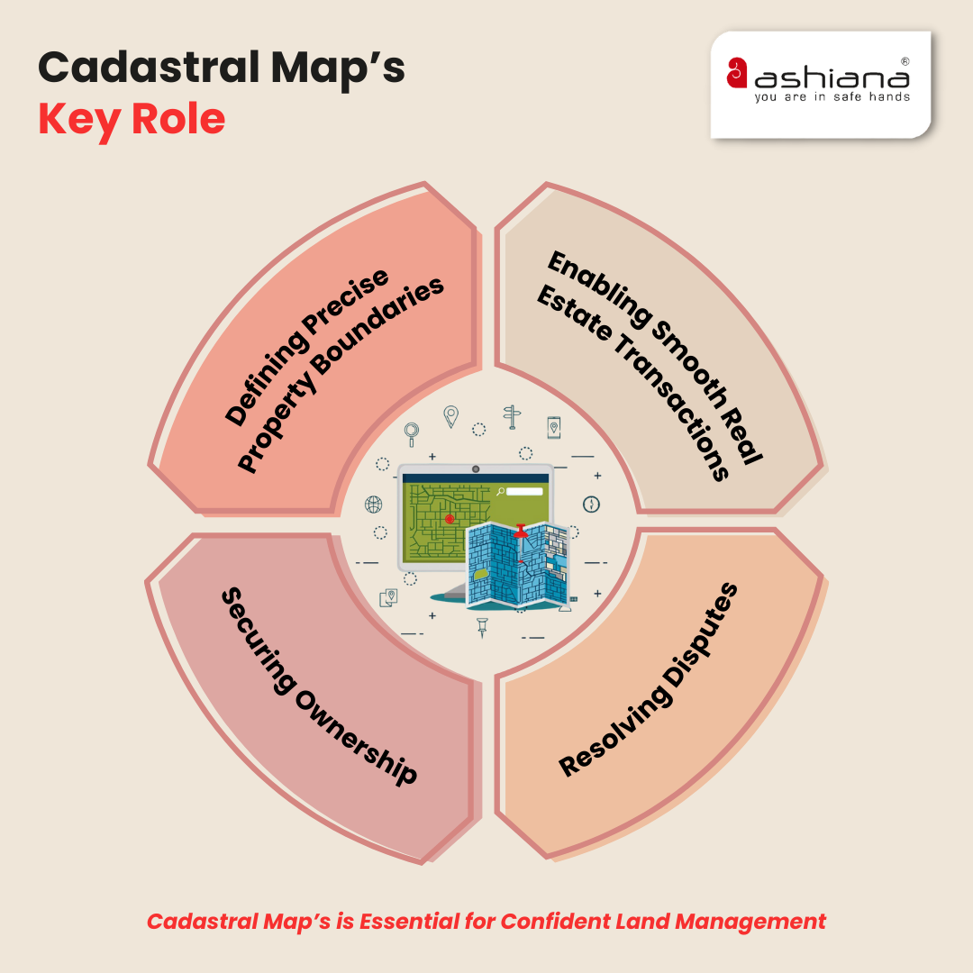
The cadastre provides accurate records of land ownership, boundaries, and property details for legal, taxation, and land management purposes. It helps resolve property disputes, plan infrastructure, and ensure proper land taxation.

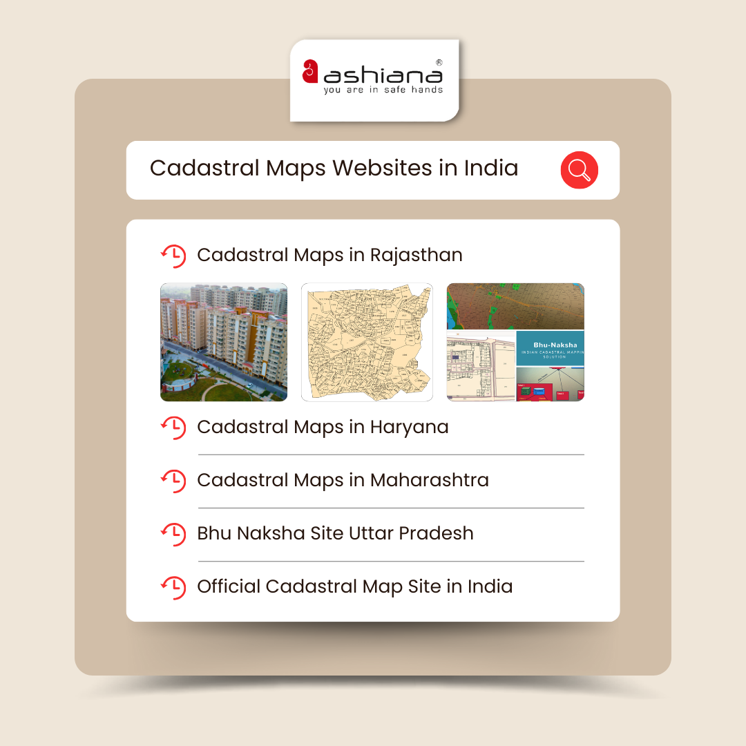
Go to the bhu naksha website (bhunaksha.raj.nic.in). From the dropdown, select the district, tehsil, village, etc. Click on plot info and plot number on the map. Click on Nakal to view the land map.

About The Author

Ashiana, Ashiana Housing build homes. Homes surrounded by vast green spaces and fresh breeze. Homes cocooned in secured gated complexes. Homes where futures are forged and there are opportunities to grow. And Homes in environments brimming with healthy activity, trust and respect. At heart, we build communities with care.

Other posts by

Free

Subscribe Now to our blog. Stay up to date with the latest real estate market, investment option, updates on senior living & kid centric world & Just enter your email address to subscribe

Join 1000+ of fellow readers. Get expert real estate knowledge straight to your inbox absolutely free. Just enter your email address below.

Get our blogs straight in your inbox,
know real estate better:
en_USEnglish
en_USEnglish

wait your request is under process

Site Visit

wait your request is under process